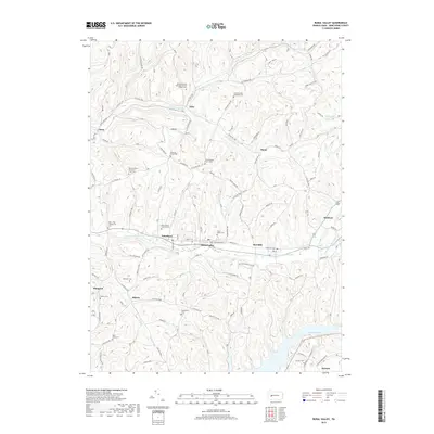
2019 Map of Rural Valley
USGS Topo · Published 2019About this map
Rural Valley and Yatesboro anchor the central valley of this Armstrong County landscape, where the waters of Cowanshannock Cr flow westward through the coal-bearing hills. The map reveals a dense network of family and community landmarks, particularly evident in the high concentration of burial grounds such as the Schreincost Farm Cem and Pleasant Union Cem. These sites, along with the Echo Methodist Episcopal Church, highlight the long-standing genealogical roots in small settlements like Echo, Bryan, and Blanco. To the southeast, the expansive Keystone Lake contrasts with the narrow stream valleys of Huskins Run and Gessner Run. The terrain is marked by the winding paths of rural routes like Kittanning Ave and State Rte 1028, which connect isolated farmsteads and historic parishes across the undulating ridges and hollows.
Find a feature on this map
102 named features on this map. Tap any name to fly to it.
Don’t see what you’re looking for? This feature index may not catch every label — zoom into the map to look around manually.
Map Details
Editions of this 2019 Rural Valley Map
This is the sole edition of this map. No revisions or reprints were ever made.
Other maps of this area

1901 · Rural Valley
USGS Topo · 1:62,500

1902 · Indiana
USGS Topo · 1:62,500

1902 · Elders Ridge
USGS Topo · 1:62,500

1903 · Rural Valley
USGS Topo · 1:62,500

1904 · Elders Ridge
USGS Topo · 1:62,500

1909 · Smicksburg
USGS Topo · 1:62,500

1938 · Smicksburg
USGS Topo · 1:62,500

1939 · Smicksburg
USGS Topo · 1:62,500

1953 · Pittsburgh
USGS Topo · 1:250,000

1954 · Pittsburgh
USGS Topo · 1:250,000