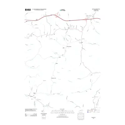
2013 Map of Rush
USGS Topo · Published 2013About this map
Means Tunnel stands as a significant landmark in this section of Boyd and Carter counties, where narrow hollows and winding creek beds dictate the placement of local communities. Small settlements like Music, Denton, and Coalton are linked by a network of rural roads that follow the natural topography of the land, including Fannin Hollow Rd and Wilson Creek Rd. Numerous family burial grounds, such as Sally Cem and O'Neal Cem, are tucked away in the higher elevations above drainage points like Williams Cr and Rush Cr. The landscape is defined by its dendritic drainage pattern, where names like Foggy Hollow and Hogshead Hollow describe the character of the terrain. This record of the early 21st century provides an important view of traditional Kentucky settlements and cemeteries before further modern development.
Find a feature on this map
121 named features on this map. Tap any name to fly to it.
Don’t see what you’re looking for? This feature index may not catch every label — zoom into the map to look around manually.
Map Details
Editions of this 2013 Rush Map
This is the sole edition of this map. No revisions or reprints were ever made.
Other maps of this area

1901 · Ceredo
USGS Topo · 1:62,500

1903 · Kenova
USGS Topo · 1:125,000

1904 · Kenova
USGS Topo · 1:125,000

1911 · Louisa
USGS Topo · 1:48,000

1913 · Ceredo
USGS Topo · 1:62,500

1913 · Louisa
USGS Topo · 1:62,500

1939 · Louisa
USGS Topo · 1:62,500

1953 · Grayson
USGS Topo · 1:24,000

1953 · Oldtown
USGS Topo · 1:24,000

1953 · Rush
USGS Topo · 1:24,000