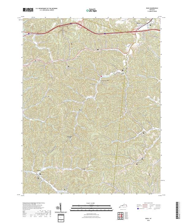
2022 Map of Rush
USGS Topo · Published 2022About this map
The boundary between Boyd and Carter Counties defines the topographic character of this Appalachian landscape, where narrow valleys dictate the paths of early settlements and road networks. Small communities like Coalton, Rush, and Music are deeply integrated into the winding drainages of Williams Creek and Glancy Fork. The map reveals a dense distribution of family and community burial grounds, such as the Rice Queen Cemetery and O'Neal Cemetery, which serve as vital markers of the area's genealogical history.
Find a feature on this map
92 named features on this map. Tap any name to fly to it.
Don’t see what you’re looking for? This feature index may not catch every label — zoom into the map to look around manually.
Map Details
Editions of this 2022 Rush Map
This is the sole edition of this map. No revisions or reprints were ever made.
Other maps of this area

1901 · Ceredo
USGS Topo · 1:62,500

1903 · Kenova
USGS Topo · 1:125,000

1904 · Kenova
USGS Topo · 1:125,000

1911 · Louisa
USGS Topo · 1:48,000

1913 · Ceredo
USGS Topo · 1:62,500

1913 · Louisa
USGS Topo · 1:62,500

1939 · Louisa
USGS Topo · 1:62,500

1953 · Grayson
USGS Topo · 1:24,000

1953 · Oldtown
USGS Topo · 1:24,000

1953 · Rush
USGS Topo · 1:24,000