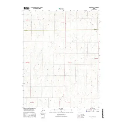
2015 Map of Rush Center SE
USGS Topo · Published 2015About this map
The boundary between Rush and Pawnee counties divides this central Kansas landscape, where the settlement of Vaughn sits amidst a network of drainage ways and section roads. This 2015 survey illustrates a rural terrain defined by its watercourses, most notably the winding path of Ash Cr which cuts through the central portion of the map. Further south, Cocklebur Cr traverses the lower townships, while Otter Cr appears in the northwest corner. The rigid geometry of the Public Land Survey System is evident in the township and range lines, including t20s r18w and t21s r18w, which dictate the placement of local thoroughfares like Ave X. The map serves as a detailed record of the contemporary agricultural layout and natural hydrology of this Great Plains region.
Find a feature on this map
13 named features on this map. Tap any name to fly to it.
Don’t see what you’re looking for? This feature index may not catch every label — zoom into the map to look around manually.
Map Details
Editions of this 2015 Rush Center SE Map
This is the sole edition of this map. No revisions or reprints were ever made.
Other maps of this area

1889 · Larned
USGS Topo · 1:125,000

1891 · Larned
USGS Topo · 1:125,000

1955 · Great Bend
USGS Topo · 1:250,000

1957 · Great Bend
USGS Topo · 1:250,000

1958 · Great Bend
USGS Topo · 1:250,000

1966 · Rush Center
USGS Topo · 1:24,000

1966 · Nekoma
USGS Topo · 1:24,000
1966 · Timken
USGS Topo · 1:24,000

1970 · Fort Larned
USGS Topo · 1:24,000
1970 · Rozel
USGS Topo · 1:24,000