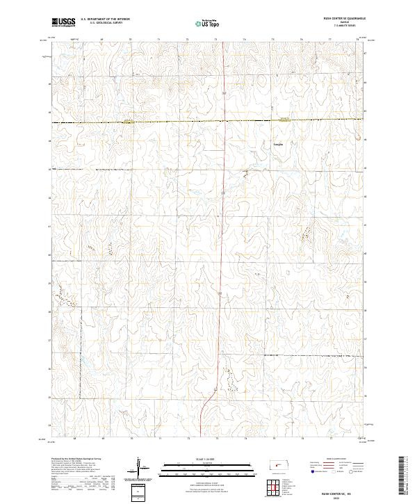
2022 Map of Rush Center SE
USGS Topo · Published 2022About this map
Vaughn stands as the primary named point of interest in this section of the Kansas plains, situated along the upper reaches of Ash Cr. The landscape is defined by the subtle drainage patterns of the High Plains, where intermittent waterways like Cocklebur Cr and Otter Cr carve shallow paths across the terrain. This 2022 survey documents the enduring geometric precision of the Public Land Survey System, with township and range lines forming a rigid framework for the rural road network. Local transport is facilitated by a grid of county routes, including Cr 280 and Ave X, which trace the section lines that have organized agricultural life in Rush and Pawnee counties for generations. The map captures the quiet, expansive character of the region, where settlement is sparse and the natural topography of the creek beds provides the only variation in an otherwise structured environment.
Find a feature on this map
20 named features on this map. Tap any name to fly to it.
Don’t see what you’re looking for? This feature index may not catch every label — zoom into the map to look around manually.
Map Details
Editions of this 2022 Rush Center SE Map
This is the sole edition of this map. No revisions or reprints were ever made.
Other maps of this area

1889 · Larned
USGS Topo · 1:125,000

1891 · Larned
USGS Topo · 1:125,000

1955 · Great Bend
USGS Topo · 1:250,000

1957 · Great Bend
USGS Topo · 1:250,000

1958 · Great Bend
USGS Topo · 1:250,000

1966 · Rush Center
USGS Topo · 1:24,000

1966 · Nekoma
USGS Topo · 1:24,000
1966 · Timken
USGS Topo · 1:24,000

1970 · Fort Larned
USGS Topo · 1:24,000
1970 · Rozel
USGS Topo · 1:24,000