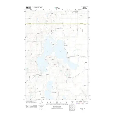
2013 Map of Rush Lake
USGS Topo · Published 2013About this map
Rush Lake and its intricate shoreline dominate this landscape on the border of Chisago and Pine counties. The expansive water body is shaped by features like La Belle Island and the Goose Lake Narrows, with the settlement of Rush City anchoring the eastern edge. This 2013 survey illustrates a region defined by recreational lakeside life and a deeply rooted rural community, evidenced by the numerous cemeteries and churches that dot the local roads.
Find a feature on this map
81 named features on this map. Tap any name to fly to it.
Don’t see what you’re looking for? This feature index may not catch every label — zoom into the map to look around manually.
Map Details
Editions of this 2013 Rush Lake Map
This is the sole edition of this map. No revisions or reprints were ever made.
Other maps of this area

1950 · Rush City
USGS Topo · 1:48,000

1953 · Stillwater
USGS Topo · 1:250,000

1955 · Rush City
USGS Topo · 1:62,500

1955 · Stillwater
USGS Topo · 1:250,000

1958 · Stillwater
USGS Topo · 1:250,000

1961 · Cambridge
USGS Topo · 1:62,500

1961 · Brook Park
USGS Topo · 1:62,500

1961 · Pine City
USGS Topo · 1:62,500

1965 · Stillwater
USGS Topo · 1:250,000

1975 · Stillwater
USGS Topo · 1:250,000