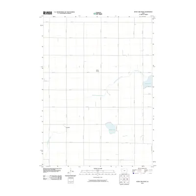
2010 Map of Rush Lake West
USGS Topo · Published 2010About this map
Leverett stands as a focal point in this agricultural landscape of northwest Iowa, situated along the grid of rural section roads. The terrain is defined by its water systems, including the headwaters of the North Branch Lizard Creek and the southern reaches of Rush Lake. Further south, Pickerel Lake and the meandering Cedar Creek transition the geography toward the drainage of the North Raccoon River at the western edge.
Find a feature on this map
36 named features on this map. Tap any name to fly to it.
Don’t see what you’re looking for? This feature index may not catch every label — zoom into the map to look around manually.
Map Details
Editions of this 2010 Rush Lake West Map
This is the sole edition of this map. No revisions or reprints were ever made.
Other maps of this area

1954 · Fairmont
USGS Topo · 1:250,000

1954 · Fort Dodge
USGS Topo · 1:250,000

1957 · Fort Dodge
USGS Topo · 1:250,000

1958 · Fort Dodge
USGS Topo · 1:250,000

1958 · Fairmont
USGS Topo · 1:250,000

1966 · Gillett Grove
USGS Topo · 1:24,000

1971 · Sioux Rapids SE
USGS Topo · 1:24,000

1971 · Albert City
USGS Topo · 1:24,000

1971 · Rush Lake East
USGS Topo · 1:24,000

1971 · Rush Lake West
USGS Topo · 1:24,000