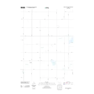
2013 Map of Rush Lake West
USGS Topo · Published 2013About this map
Leverett stands as a primary point of reference in this corner of northwest Iowa, situated just north of where the N Raccoon River winds through the landscape. The region is defined by its agricultural grid and a series of distinct glacial water bodies, most notably Rush Lake in the northeast and Pickerel Lake near the center of the sheet. These lakes, along with several drainage systems like N Br Lizard Cr and Cedar Cr, break the rigid pattern of section-line roads such as Co Line Rd and Potato Farm Rd. The topography here reflects the typical prairie pothole region, where subtle elevation changes dictate the flow of the creeks and the location of the remaining natural wetlands. This survey provides a clear view of the rural infrastructure at the start of the 2010s, tracing the paths of numerous numbered avenues and streets that connect the disparate farmsteads and fields of Buena Vista County.
Find a feature on this map
36 named features on this map. Tap any name to fly to it.
Don’t see what you’re looking for? This feature index may not catch every label — zoom into the map to look around manually.
Map Details
Editions of this 2013 Rush Lake West Map
This is the sole edition of this map. No revisions or reprints were ever made.
Other maps of this area

1954 · Fairmont
USGS Topo · 1:250,000

1954 · Fort Dodge
USGS Topo · 1:250,000

1957 · Fort Dodge
USGS Topo · 1:250,000

1958 · Fort Dodge
USGS Topo · 1:250,000

1958 · Fairmont
USGS Topo · 1:250,000

1966 · Gillett Grove
USGS Topo · 1:24,000

1971 · Sioux Rapids SE
USGS Topo · 1:24,000

1971 · Albert City
USGS Topo · 1:24,000

1971 · Rush Lake East
USGS Topo · 1:24,000

1971 · Rush Lake West
USGS Topo · 1:24,000