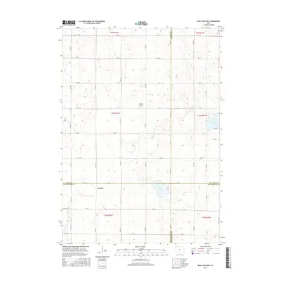
2015 Map of Rush Lake West
USGS Topo · Published 2015About this map
Leverett serves as a central point in this rural landscape where four Iowa counties—Clay, Palo Alto, Buena Vista, and Pocahontas—converge. The terrain is defined by its glacial hydrology, featuring the eponymous Rush Lake in the northeast and Pickerel Lake situated further south. These water bodies, along with the meandering course of the N Raccoon River and the headwaters of the N Br Lizard Cr, illustrate the complex drainage patterns of the region. A strict section-line road grid, including CO Hwy N 14 and Co Line Rd, anchors the agricultural plots. Local heritage is preserved at the Garfield Township Cem, providing a focal point for genealogical interest in a township otherwise dedicated to wide-scale farming and natural riparian corridors like Cedar Cr.
Find a feature on this map
51 named features on this map. Tap any name to fly to it.
Don’t see what you’re looking for? This feature index may not catch every label — zoom into the map to look around manually.
Map Details
Editions of this 2015 Rush Lake West Map
This is the sole edition of this map. No revisions or reprints were ever made.
Other maps of this area

1954 · Fairmont
USGS Topo · 1:250,000

1954 · Fort Dodge
USGS Topo · 1:250,000

1957 · Fort Dodge
USGS Topo · 1:250,000

1958 · Fort Dodge
USGS Topo · 1:250,000

1958 · Fairmont
USGS Topo · 1:250,000

1966 · Gillett Grove
USGS Topo · 1:24,000

1971 · Sioux Rapids SE
USGS Topo · 1:24,000

1971 · Albert City
USGS Topo · 1:24,000

1971 · Rush Lake East
USGS Topo · 1:24,000

1971 · Rush Lake West
USGS Topo · 1:24,000