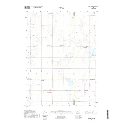
2018 Map of Rush Lake West
USGS Topo · Published 2018About this map
Leverett sits at the intersection of Buena Vista and Clay counties, serving as a primary point of interest in this agricultural landscape. The area is defined by its complex hydrography, where the headwaters of several regional water systems emerge from the prairie. The N Raccoon River flows through the southwestern corner, while N Br Lizard Cr and Cedar Cr drain the central and eastern portions. Local history is centered at the Garfield Township Cem, located near the intersection of 330th Ave and 480th St. The map illustrates a high-density grid of county roads, such as Co Hwy N 14 and Co Line Rd, which facilitate movement across the state's characteristic township-and-range land divisions. Natural features like Rush Lake and Pickerel Lake provide breaks in the expansive farm plots that dominate the four-county junction.
Find a feature on this map
51 named features on this map. Tap any name to fly to it.
Don’t see what you’re looking for? This feature index may not catch every label — zoom into the map to look around manually.
Map Details
Editions of this 2018 Rush Lake West Map
This is the sole edition of this map. No revisions or reprints were ever made.
Other maps of this area

1954 · Fairmont
USGS Topo · 1:250,000

1954 · Fort Dodge
USGS Topo · 1:250,000

1957 · Fort Dodge
USGS Topo · 1:250,000

1958 · Fort Dodge
USGS Topo · 1:250,000

1958 · Fairmont
USGS Topo · 1:250,000

1966 · Gillett Grove
USGS Topo · 1:24,000

1971 · Sioux Rapids SE
USGS Topo · 1:24,000

1971 · Albert City
USGS Topo · 1:24,000

1971 · Rush Lake East
USGS Topo · 1:24,000

1971 · Rush Lake West
USGS Topo · 1:24,000