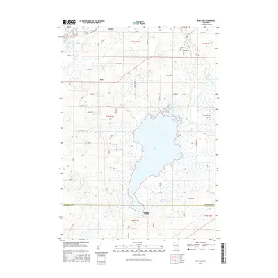
2015 Map of Rush Lake
USGS Topo · Published 2015About this map
Rush Lake dominates this mid-2010s landscape, its expansive shoreline defining the geography of southwestern Winnebago County. The map details a primarily agricultural region interspersed with small settlements and rural crossroads like Eureka, Waukau, and Koro. The lake's distinct indentations, such as Green Bay and Gleason Bay, provide a clear view of the water-land interface that has likely influenced local property lines and recreational patterns for generations. To the north, the Fox River cuts through the terrain near the Winnebago and Fond du Lac county line.
Find a feature on this map
69 named features on this map. Tap any name to fly to it.
Don’t see what you’re looking for? This feature index may not catch every label — zoom into the map to look around manually.
Map Details
Editions of this 2015 Rush Lake Map
This is the sole edition of this map. No revisions or reprints were ever made.
Other maps of this area

1916 · Ripon
USGS Topo · 1:48,000

1918 · Ripon
USGS Topo · 1:62,500

1955 · Green Bay
USGS Topo · 1:250,000

1956 · Ripon
USGS Topo · 1:62,500

1956 · Rosendale
USGS Topo · 1:62,500

1957 · Madison
USGS Topo · 1:250,000

1960 · Madison
USGS Topo · 1:250,000

1961 · Poy Sippi
USGS Topo · 1:62,500

1961 · Oshkosh
USGS Topo · 1:62,500
1961 · Auroraville
USGS Topo · 1:24,000