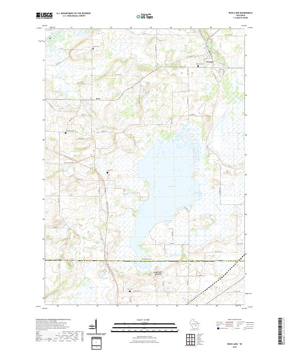
2022 Map of Rush Lake
USGS Topo · Published 2022About this map
Rush Lake dominates this central Wisconsin landscape, its sprawling waters punctuated by Green Bay and Gleason Bay as it straddles the line between Winnebago and Fond du Lac counties. The settlement pattern is defined by small clusters of community life such as Waukau in the northeast and Koro to the west, connected by a rigid grid of rural roads like Schuster Rd and Co Rd E. The presence of numerous historic burial grounds, including Eureka Cem, Waukau Cem, and Nepeuskun Cem, points to the long-standing agricultural roots of the area.
Find a feature on this map
72 named features on this map. Tap any name to fly to it.
Don’t see what you’re looking for? This feature index may not catch every label — zoom into the map to look around manually.
Map Details
Editions of this 2022 Rush Lake Map
This is the sole edition of this map. No revisions or reprints were ever made.
Other maps of this area

1916 · Ripon
USGS Topo · 1:48,000

1918 · Ripon
USGS Topo · 1:62,500

1955 · Green Bay
USGS Topo · 1:250,000

1956 · Ripon
USGS Topo · 1:62,500

1956 · Rosendale
USGS Topo · 1:62,500

1957 · Madison
USGS Topo · 1:250,000

1960 · Madison
USGS Topo · 1:250,000

1961 · Poy Sippi
USGS Topo · 1:62,500

1961 · Oshkosh
USGS Topo · 1:62,500
1961 · Auroraville
USGS Topo · 1:24,000