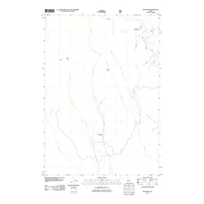
2011 Map of Rush Peak
USGS Topo · Published 2011About this map
Rush Peak and the high basins of Washington County define this landscape of the early 21st century, where a complex network of drainages flows through the Idaho backcountry. The terrain is characterized by steep descents and seasonal watercourses, highlighted by the drop at Rush Falls and the broad reach of Big Flat. The map reveals a land utilized for its open spaces and natural resources, connected by primitive routes like Cow Creek Rd and Ward Rd.
Find a feature on this map
19 named features on this map. Tap any name to fly to it.
Don’t see what you’re looking for? This feature index may not catch every label — zoom into the map to look around manually.
Map Details
Editions of this 2011 Rush Peak Map
This is the sole edition of this map. No revisions or reprints were ever made.
Other maps of this area

1955 · Baker
USGS Topo · 1:250,000

1957 · Cambridge
USGS Topo · 1:62,500

1957 · Copperfield
USGS Topo · 1:62,500

1957 · Hornet
USGS Topo · 1:62,500

1957 · Sturgill Peak
USGS Topo · 1:62,500

1959 · Baker
USGS Topo · 1:250,000

1980 · McCall
USGS Topo · 1:100,000

1986 · Peck Mountain
USGS Topo · 1:24,000
1986 · Crooked River Point
USGS Topo · 1:24,000
1986 · East of Cambridge
USGS Topo · 1:24,000