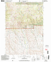
2004 Map of Rush Peak
USGS Topo · Published 2007About this map
The Cuddy Mountains dominate this 2004 revision of the Payette region, where the steep terrain of the Payette National Forest drops toward the Washington-Adams county line. The map illustrates a landscape defined by significant elevation changes, from the high point at Rush Peak down to the drainage networks of Rush Creek and Calamity Creek. The Council Weiser Ranger District boundary marks the central portion of the sheet, overseeing a network of forest roads and trails that navigate the Grizzly Basin and Big Flat.
Find a feature on this map
22 named features on this map. Tap any name to fly to it.
Don’t see what you’re looking for? This feature index may not catch every label — zoom into the map to look around manually.
Map Details
Editions of this 2004 Rush Peak Map
This is the sole edition of this map. No revisions or reprints were ever made.
Other maps of this area

1955 · Baker
USGS Topo · 1:250,000

1957 · Cambridge
USGS Topo · 1:62,500

1957 · Copperfield
USGS Topo · 1:62,500

1957 · Hornet
USGS Topo · 1:62,500

1957 · Sturgill Peak
USGS Topo · 1:62,500

1959 · Baker
USGS Topo · 1:250,000

1980 · McCall
USGS Topo · 1:100,000

1986 · Peck Mountain
USGS Topo · 1:24,000
1986 · Crooked River Point
USGS Topo · 1:24,000
1986 · East of Cambridge
USGS Topo · 1:24,000