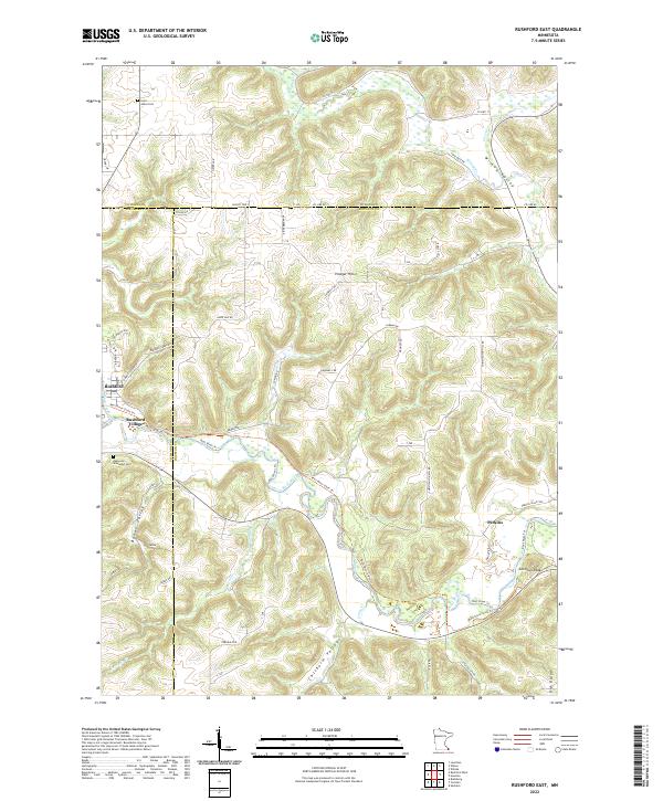
2022 Map of Rushford East
USGS Topo · Published 2022About this map
The Root River meanders through a landscape of deep valleys and prominent ridges, anchoring the settlements of Rushford and Rushford Village. This modern topographic survey reveals the complex drainage patterns of the area, where Money Cr, Ferndale Cr, and Daley Cr cut through the high ground of Oak Ridge and Vinegar Hill. The recreational transformation of the region is evident in the path of the Root River State Trail, which follows the river's winding course across the county line between Winona and Houston. Genealogists will find the locations of Saint Johns Cem and the Oakwood - Sherwood Cem clearly marked. The map also documents smaller locales like Perkins and high points such as Cushings Peak, providing a comprehensive look at the rural road network including Co HWY 17 and Co HWY 27.
Find a feature on this map
64 named features on this map. Tap any name to fly to it.
Don’t see what you’re looking for? This feature index may not catch every label — zoom into the map to look around manually.
Map Details
Editions of this 2022 Rushford East Map
This is the sole edition of this map. No revisions or reprints were ever made.
Other maps of this area

1954 · Lewiston
USGS Topo · 1:62,500

1958 · Houston
USGS Topo · 1:62,500

1958 · La Crosse
USGS Topo · 1:250,000

1961 · La Crosse
USGS Topo · 1:250,000

1965 · La Crosse
USGS Topo · 1:250,000

1965 · Sheldon
USGS Topo · 1:24,000

1965 · Yucatan
USGS Topo · 1:24,000

1965 · Bratsberg
USGS Topo · 1:24,000
1974 · Rushford West
USGS Topo · 1:24,000
1974 · Lewiston
USGS Topo · 1:24,000