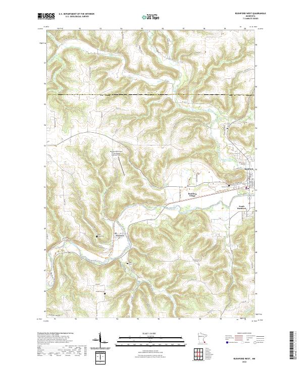
2022 Map of Rushford West
USGS Topo · Published 2022About this map
The deep valley of the Root River carves a distinctive path through the blufflands of southeastern Minnesota, defining the settlement patterns of Rushford and the nearby village of Peterson. This 2022 survey captures a landscape where river-bottom agriculture and high-ground ridges like Pigtail Ridge and Tower Ridge dictate the layout of the local road network. Modern transportation and recreation intersect here as the Root River State Trl follows the waterway through the heart of Rushford Village, tracing a corridor once vital to the region's development.
Find a feature on this map
67 named features on this map. Tap any name to fly to it.
Don’t see what you’re looking for? This feature index may not catch every label — zoom into the map to look around manually.
Map Details
Editions of this 2022 Rushford West Map
This is the sole edition of this map. No revisions or reprints were ever made.
Other maps of this area

1954 · Lewiston
USGS Topo · 1:62,500

1958 · Houston
USGS Topo · 1:62,500

1958 · La Crosse
USGS Topo · 1:250,000

1961 · La Crosse
USGS Topo · 1:250,000

1965 · La Crosse
USGS Topo · 1:250,000

1965 · Yucatan
USGS Topo · 1:24,000

1965 · Bratsberg
USGS Topo · 1:24,000
1965 · Lanesboro
USGS Topo · 1:24,000
1974 · Rushford West
USGS Topo · 1:24,000
1974 · Utica
USGS Topo · 1:24,000
Featured Places
- Rushford, MN
- Rushford Village, MN
- Peterson, MN
- South Rushford, Rushford Village
- Bluffview Park Mobile Home Park, Rushford