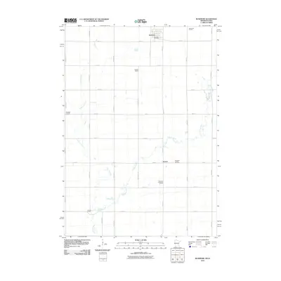
2010 Map of Rushmore
USGS Topo · Published 2010About this map
Rushmore serves as the primary population center on this Nobles County landscape, centered around the Rushmore Post Office and a grid of residential and commercial streets. The surrounding territory is defined by the headwaters of the Little Rock River and its tributary, Little Rock Creek, which wind through a predominantly agricultural grid. The importance of local heritage is visible in the distribution of community sites, including the Rohwer Airport and several historic burial grounds. Genealogists and local historians will find value in the specific locations of the Sunset Rest Cemetery, Norwegian Lutheran Cemetery, and Emmanuel Presbyterian Cemetery. To the south, the small settlement of Ransom sits near the river, illustrating the dispersed rural settlement pattern of southwestern Minnesota in the early 21st century.
Find a feature on this map
27 named features on this map. Tap any name to fly to it.
Don’t see what you’re looking for? This feature index may not catch every label — zoom into the map to look around manually.
Map Details
Editions of this 2010 Rushmore Map
This is the sole edition of this map. No revisions or reprints were ever made.
Other maps of this area

1954 · Fairmont
USGS Topo · 1:250,000

1958 · Fairmont
USGS Topo · 1:250,000

1960 · Reading
USGS Topo · 1:24,000

1960 · Bigelow
USGS Topo · 1:24,000

1967 · Rushmore
USGS Topo · 1:24,000

1967 · Adrian SW
USGS Topo · 1:24,000

1967 · Adrian NE
USGS Topo · 1:24,000

1967 · Adrian
USGS Topo · 1:24,000
1972 · Little Rock
USGS Topo · 1:24,000

1972 · Sibley West
USGS Topo · 1:24,000