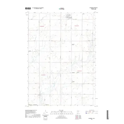
2019 Map of Rushmore
USGS Topo · Published 2019About this map
The settlement of Rushmore anchors this 2019 survey of the southwestern Minnesota prairie, where a precise grid of county roads divides the productive agricultural landscape. Situated within the notable Coteau des Prairies upland, the area is defined by the winding course of the Little Rock River and its tributary, Little Rock Cr. These waterways carve through the terrain, contrasting with the straight lines of the public land survey system. Local history and genealogy are preserved in the community's dispersed burial grounds, including Sunset Rest Cem near the town center and the Norwegian Lutheran Cem and Emmanuel Presbyterian Cem further south. The map also identifies the small settlement of Ransom and the Sunrise Cem at the southern edge, reflecting the enduring rural character and lineage of Nobles County during this recent decade.
Find a feature on this map
44 named features on this map. Tap any name to fly to it.
Don’t see what you’re looking for? This feature index may not catch every label — zoom into the map to look around manually.
Map Details
Editions of this 2019 Rushmore Map
This is the sole edition of this map. No revisions or reprints were ever made.
Other maps of this area

1954 · Fairmont
USGS Topo · 1:250,000

1958 · Fairmont
USGS Topo · 1:250,000

1960 · Reading
USGS Topo · 1:24,000

1960 · Bigelow
USGS Topo · 1:24,000

1967 · Rushmore
USGS Topo · 1:24,000

1967 · Adrian SW
USGS Topo · 1:24,000

1967 · Adrian NE
USGS Topo · 1:24,000

1967 · Adrian
USGS Topo · 1:24,000
1972 · Little Rock
USGS Topo · 1:24,000

1972 · Sibley West
USGS Topo · 1:24,000