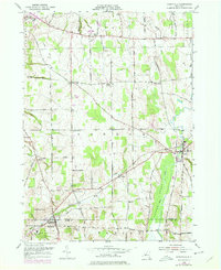
1952 Map of Rushville
USGS Topo · Published 1978About this map
The village of Rushville sits at the southern edge of this Finger Lakes region landscape, straddling the line between Ontario and Yates Counties. The terrain is defined by north-south drainage patterns, most notably the wide expanse of Potter Swamp and Flint Creek, which run parallel to agricultural crossroads like Baldwin Corners and Gorham. The 1950s topography reveals a rural network of family-named landmarks and small community centers, including Reed Corners and Babbitt Corner.
Find a feature on this map
65 named features on this map. Tap any name to fly to it.
Don’t see what you’re looking for? This feature index may not catch every label — zoom into the map to look around manually.
Map Details
Editions of this 1952 Rushville Map
Other maps of this area

1900 · Naples
USGS Topo · 1:62,500

1900 · Canandaigua
USGS Topo · 1:62,500

1902 · Phelps
USGS Topo · 1:62,500

1903 · Naples
USGS Topo · 1:62,500

1903 · Canandaigua
USGS Topo · 1:62,500

1903 · Penn Yan
USGS Topo · 1:62,500

1913 · Naples
USGS Topo · 1:62,500

1942 · Penn Yan
USGS Topo · 1:31,680

1942 · Middlesex
USGS Topo · 1:31,680

1942 · Canandaigua
USGS Topo · 1:31,680