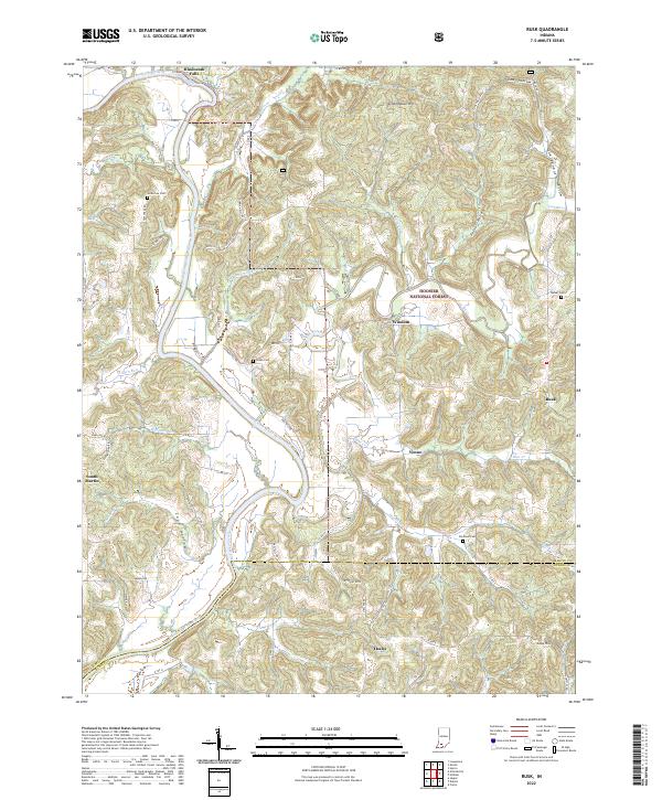
2022 Map of Rusk
USGS Topo · Published 2022About this map
Hindostan Falls marks a significant hydrological point on the East Fork White River as it winds through this portion of Southern Indiana. The landscape is defined by the steep relief of the Hoosier National Forest, where the river makes deep meanders around landforms like Schoolhouse Hill and Goss Hill. This survey captures a network of small rural settlements including Rusk, Windom, Yenne, and Thales, many of which are connected by winding county roads like N Hickory Grove Rd and Kale Crossing Rd. Genealogists will find several family and community burial sites scattered across the terrain, such as Holtsclaw Cem and Green Cem. The map illustrates the complex drainage patterns of the region, where the Lost River and Blue Cr intersect with numerous named hollows, including Qualkenbush Hollow and Horner Hollow, reflecting the area's intricate topography.
Find a feature on this map
58 named features on this map. Tap any name to fly to it.
Don’t see what you’re looking for? This feature index may not catch every label — zoom into the map to look around manually.
Map Details
Editions of this 2022 Rusk Map
This is the sole edition of this map. No revisions or reprints were ever made.
Other maps of this area

1946 · Jasper
USGS Topo · 1:24,000

1948 · Huron
USGS Topo · 1:24,000

1950 · Huron
USGS Topo · 1:24,000

1950 · Shoals
USGS Topo · 1:24,000

1951 · Hillham
USGS Topo · 1:24,000

1954 · Dubois
USGS Topo · 1:24,000

1956 · Alfordsville
USGS Topo · 1:24,000

1956 · Loogootee
USGS Topo · 1:24,000

1956 · Rusk
USGS Topo · 1:24,000

1956 · Vincennes
USGS Topo · 1:250,000