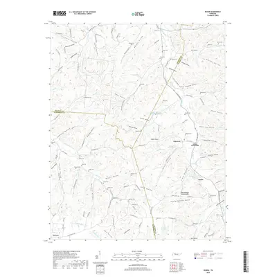
2019 Map of Ruskin
USGS Topo · Published 2019About this map
Ruskin Cave Spring and the settlement of Ruskin serve as a focal point for this survey of the Tennessee interior where Houston, Dickson, and Humphreys counties meet. The landscape is defined by a dense network of hollows, such as Randolph Hollow and Tubbs Hollow, which have historically dictated the placement of small communities and family cemeteries. These burial grounds, including Nichols Cem, Potter Cem, and Edgewood Cem, are scattered across the high ground of Nubbin Ridge and the drainages of Whiteoak Cr.
Find a feature on this map
140 named features on this map. Tap any name to fly to it.
Don’t see what you’re looking for? This feature index may not catch every label — zoom into the map to look around manually.
Map Details
Editions of this 2019 Ruskin Map
This is the sole edition of this map. No revisions or reprints were ever made.
Other maps of this area

1931 · Erin
USGS Topo · 1:62,500

1936 · Gorman
USGS Topo · 1:24,000

1936 · Tantrough Hollow
USGS Topo · 1:24,000

1936 · Woolworth
USGS Topo · 1:24,000

1936 · Ruskin
USGS Topo · 1:24,000

1936 · Tennessee City
USGS Topo · 1:24,000

1936 · Dickson
USGS Topo · 1:24,000
1952 · Mc Ewen
USGS Topo · 1:24,000
1952 · Woolworth
USGS Topo · 1:24,000

1953 · Dickson
USGS Topo · 1:24,000