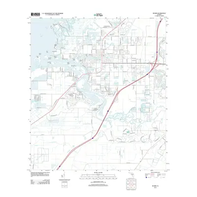
2012 Map of Ruskin
USGS Topo · Published 2012About this map
The Little Manatee River serves as the central artery for this coastal Florida landscape, winding through a network of bayous and inlets before emptying into Tampa Bay. The community of Ruskin is defined by its relationship with the water, where Mill Bayou, Hayes Bayou, and Bolster Bayou create a complex shoreline of points and islands. Local history is anchored at the Ruskin Cem and Ruskin Memorial Gardens, while the iconic Ruskin Family Drive-In stands as a local landmark. The coastline is a mosaic of conservation and recreation, ranging from the mangroves at Mangrove Point to the sands of Bahia Beach. Smaller keys and islands like Snake Island and Whiskey Key populate the mouth of Cockroach Bay, illustrating the intricate geography of the Gulf coast's tidal systems.
Find a feature on this map
111 named features on this map. Tap any name to fly to it.
Don’t see what you’re looking for? This feature index may not catch every label — zoom into the map to look around manually.
Map Details
Editions of this 2012 Ruskin Map
This is the sole edition of this map. No revisions or reprints were ever made.
Other maps of this area

1921 · Tampa
USGS Topo · 1:62,500

1921 · Fort De Soto
USGS Topo · 1:62,500

1921 · St Petersburg
USGS Topo · 1:62,500

1942 · Cockroach Bay
USGS Topo · 1:31,680

1943 · Port Tampa
USGS Topo · 1:31,680

1944 · Ruskin
USGS Topo · 1:31,680

1944 · Rye
USGS Topo · 1:31,680

1944 · Wimauma
USGS Topo · 1:31,680

1944 · Ellenton
USGS Topo · 1:31,680

1944 · Parish
USGS Topo · 1:31,680