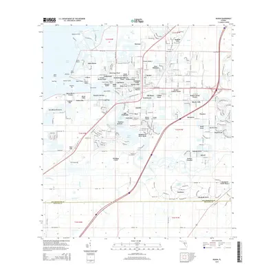
2015 Map of Ruskin
USGS Topo · Published 2015About this map
The Little Manatee River and its intricate network of bayous and inlets define this coastal landscape near the Hillsborough and Manatee county line. The settlement of Ruskin serves as the primary hub, surrounded by a dense cluster of residential developments such as Ruskin Colony Farms, College Chase, and Sill Manor. The map reveals a transition from these established neighborhoods to the preservation lands of the Lost River Preserve and the tidal marshes surrounding Cockroach Cr.
Find a feature on this map
87 named features on this map. Tap any name to fly to it.
Don’t see what you’re looking for? This feature index may not catch every label — zoom into the map to look around manually.
Map Details
Editions of this 2015 Ruskin Map
This is the sole edition of this map. No revisions or reprints were ever made.
Other maps of this area

1921 · Tampa
USGS Topo · 1:62,500

1921 · Fort De Soto
USGS Topo · 1:62,500

1921 · St Petersburg
USGS Topo · 1:62,500

1942 · Cockroach Bay
USGS Topo · 1:31,680

1943 · Port Tampa
USGS Topo · 1:31,680

1944 · Ruskin
USGS Topo · 1:31,680

1944 · Rye
USGS Topo · 1:31,680

1944 · Wimauma
USGS Topo · 1:31,680

1944 · Ellenton
USGS Topo · 1:31,680

1944 · Parish
USGS Topo · 1:31,680