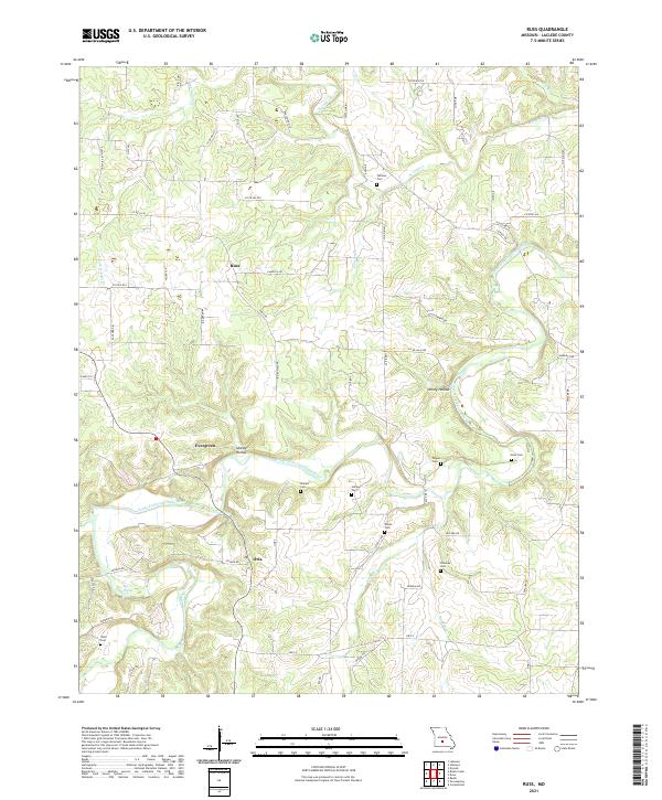
2021 Map of Russ
USGS Topo · Published 2021About this map
The Osage Fork Gasconade River winds through this section of Laclede County, shaping a landscape defined by its waterways and small rural settlements. Small communities like Evergreen and Russ serve as focal points in an area marked by a high density of family and community burial grounds, such as Whitson Cem, Sharpe Cem, and Amos Cem. These sites, along with others like Holman Cem and Moore Cem, provide significant touchpoints for genealogical research in this part of Missouri.
Find a feature on this map
63 named features on this map. Tap any name to fly to it.
Don’t see what you’re looking for? This feature index may not catch every label — zoom into the map to look around manually.
Map Details
Editions of this 2021 Russ Map
This is the sole edition of this map. No revisions or reprints were ever made.
Other maps of this area

1931 · Manes
USGS Topo · 1:48,000

1941 · Manes
USGS Topo · 1:62,500

1941 · Lebanon
USGS Topo · 1:62,500

1943 · Lebanon
USGS Topo · 1:62,500

1943 · Manes
USGS Topo · 1:62,500

1943 · Drynob
USGS Topo · 1:62,500

1954 · Springfield
USGS Topo · 1:250,000

1954 · Drynob
USGS Topo · 1:62,500

1954 · Drew
USGS Topo · 1:24,000
1954 · Drynob
USGS Topo · 1:24,000