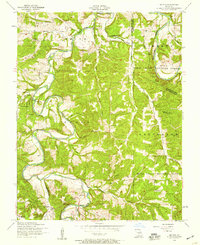
1954 Map of Drynob
USGS Topo · Published 1959About this map
Osage Fork and the Gasconade River dominate this mid-century portrait of Laclede and Pulaski Counties. The terrain is a network of hollows and ridges, including Murrell Hollow and Basin Hollow, where life was organized around small creek-side settlements and rural schoolhouses. The map reveals a community in transition during the 1950s, specifically noting several educational landmarks as defunct, such as Prairie Creek School and Stockdale School.
Find a feature on this map
36 named features on this map. Tap any name to fly to it.
Don’t see what you’re looking for? This feature index may not catch every label — zoom into the map to look around manually.
Map Details
Editions of this 1954 Drynob Map
2 editions found
Other maps of this area

1933 · Stoutland
USGS Topo · 1:62,500

1938 · Stoutland
USGS Topo · 1:62,500

1941 · Lebanon
USGS Topo · 1:62,500

1943 · Richland
USGS Topo · 1:62,500

1943 · Lebanon
USGS Topo · 1:62,500

1943 · Drynob
USGS Topo · 1:62,500

1954 · Springfield
USGS Topo · 1:250,000

1954 · Drynob
USGS Topo · 1:62,500
1954 · Richland
USGS Topo · 1:62,500

1954 · Drew
USGS Topo · 1:24,000