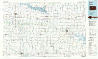
1985 Map of Russell
USGS Topo · Published 1985About this map
Oil Field developments dominate the central Kansas plains in this mid-1980s look at the region spanning Russell and Ellsworth counties. The landscape is defined by the intersection of industrial energy extraction and significant water management projects, most notably the massive Wilson Lake and Kanopolis Lake reservoirs. These water bodies, along with the Saline River and Smoky Hill River, provide the primary breaks in a grid of section lines and rural homesteads. The southern portion of the map is anchored by the unique wetland geography of Cheyenne Bottoms, a critical ecological feature flanked by the Cheyenne Bottoms State Wildlife Area.
Find a feature on this map
80 named features on this map. Tap any name to fly to it.
Don’t see what you’re looking for? This feature index may not catch every label — zoom into the map to look around manually.
Map Details
Editions of this 1985 Russell Map
2 editions found
Other maps of this area

1889 · Larned
USGS Topo · 1:125,000

1891 · Great Bend
USGS Topo · 1:125,000

1891 · Larned
USGS Topo · 1:125,000

1891 · Hutchinson
USGS Topo · 1:125,000

1892 · Salina
USGS Topo · 1:125,000

1892 · Minneapolis
USGS Topo · 1:125,000

1893 · Great Bend
USGS Topo · 1:125,000

1893 · Hutchinson
USGS Topo · 1:125,000

1894 · Ellsworth
USGS Topo · 1:125,000

1894 · Lyons
USGS Topo · 1:125,000