
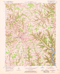
1954 Map of Russell Springs
USGS Topo · Published 1955About this map
Russell Springs serves as the primary hub of this mid-century landscape, positioned at the junction of several state routes including KY 80 and KY 35. The 1954 field check captures the area just as the newly formed Lake Cumberland was beginning to shape the local geography along the southeastern corner, with the margin noting the waters were subject to controlled inundation. Away from the lake, the terrain is defined by a dense network of ridges such as Beckham Ridge, Half Acre Ridge, and McClendon Ridge, which dictate the placement of small rural communities and family-named landmarks.
Find a feature on this map
67 named features on this map. Tap any name to fly to it.
Don’t see what you’re looking for? This feature index may not catch every label — zoom into the map to look around manually.
Map Details
Editions of this 1954 Russell Springs Map
2 editions found
Other maps of this area

1911 · Monticello
USGS Topo · 1:62,500

1914 · Monticello
USGS Topo · 1:62,500

1953 · Phil
USGS Topo · 1:24,000

1953 · Montpelier
USGS Topo · 1:24,000

1953 · Creelsboro
USGS Topo · 1:24,000

1953 · Jamestown
USGS Topo · 1:24,000

1953 · Dunnville
USGS Topo · 1:24,000

1954 · Jabez
USGS Topo · 1:24,000

1954 · Knifley
USGS Topo · 1:24,000

1954 · Eli
USGS Topo · 1:24,000