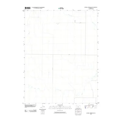
2009 Map of Russell Springs SE
USGS Topo · Published 2009About this map
The Smoky Hill River flows through the northern reaches of this Logan County landscape, carving a subtle path through the High Plains. To the south, the drainage of Twin Butte Creek meanders across the territory, illustrating the hydrological patterns of western Kansas. This 2009 survey highlights a structured grid of rural roads that facilitate movement across the open plains, including named routes such as Lariat and Indian. The alignment of these roads, alongside Co Rd 340 and Co Rd 320, reflects the enduring section-line infrastructure of the region. This document serves as a precise record of the land's surface and drainage at the start of the 21st century, showing how modern transportation routes continue to navigate around the natural watercourses of the Kansas prairie.
Find a feature on this map
6 named features on this map. Tap any name to fly to it.
Don’t see what you’re looking for? This feature index may not catch every label — zoom into the map to look around manually.
Map Details
Editions of this 2009 Russell Springs SE Map
This is the sole edition of this map. No revisions or reprints were ever made.
Other maps of this area

1939 · Lake Mc Bride
USGS Topo · 1:24,000

1939 · Sandon
USGS Topo · 1:62,500

1939 · Pence
USGS Topo · 1:62,500

1941 · Pence
USGS Topo · 1:62,500

1942 · Sandon
USGS Topo · 1:62,500

1942 · Lake Mc Bride
USGS Topo · 1:31,680

1955 · Scott City
USGS Topo · 1:250,000

1958 · Scott City
USGS Topo · 1:250,000

1972 · Russell Springs
USGS Topo · 1:24,000

1972 · Elkader NW
USGS Topo · 1:24,000