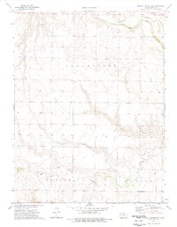
1974 Map of Russell Springs SE
USGS Topo · Published 1977About this map
The Smoky Hill River winds through the northern portion of this Logan County landscape, a vital watercourse in a region defined by its broad drainage basins and rural township divisions. Traces of 19th-century western migration and early transportation are etched into the terrain, most notably the Butterfield Overland Location Trail which parallels the river valley. The map documents the persistent marks of human industry and infrastructure, including an Old Railroad Grade and several local Gravel Pits. In the southern half of the quadrangle, Twin Butte Creek cuts through the townships of Paxton and Lees, illustrating the natural drainage patterns that guided the boundaries of these early Kansas land divisions. This 1974 survey captures the high plains character of the region just as modern photogrammetric mapping began to provide precise topographic detail of its landforms.
Find a feature on this map
8 named features on this map. Tap any name to fly to it.
Don’t see what you’re looking for? This feature index may not catch every label — zoom into the map to look around manually.
Map Details
Editions of this 1974 Russell Springs SE Map
This is the sole edition of this map. No revisions or reprints were ever made.
Other maps of this area

1939 · Lake Mc Bride
USGS Topo · 1:24,000

1939 · Sandon
USGS Topo · 1:62,500

1939 · Pence
USGS Topo · 1:62,500

1941 · Pence
USGS Topo · 1:62,500

1942 · Sandon
USGS Topo · 1:62,500

1942 · Lake Mc Bride
USGS Topo · 1:31,680

1955 · Scott City
USGS Topo · 1:250,000

1958 · Scott City
USGS Topo · 1:250,000

1972 · Russell Springs
USGS Topo · 1:24,000

1972 · Elkader NW
USGS Topo · 1:24,000