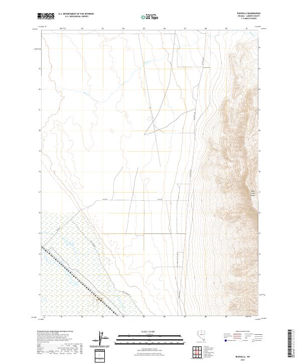
2021 Map of Russells
USGS Topo · Published 2021About this map
The Sheep Creek Range dominates the eastern portion of this landscape in Lander County, creating a sharp topographical contrast with the alluvial plains to the west. This desert basin is defined by intermittent water features like Sheep Cr and the complex drainage of McIntyre Slough, which winds through the southern townships. The map documents a sparse but vital network of infrastructure necessary for navigating this high-desert environment, including Izzenhood Rd and Mote Rd. The presence of McIntyre Slough suggests a landscape shaped by seasonal water flow and drainage patterns that dictate the location of local thoroughfares like Rock Creek Rd. This survey provides a precise modern record of public land divisions across six different townships, reflecting the enduring importance of the Public Land Survey System in managing the Nevada interior.
Find a feature on this map
12 named features on this map. Tap any name to fly to it.
Don’t see what you’re looking for? This feature index may not catch every label — zoom into the map to look around manually.
Map Details
Editions of this 2021 Russells Map
This is the sole edition of this map. No revisions or reprints were ever made.
Other maps of this area

1932 · Sonoma Range
USGS Topo · 1:250,000

1939 · Sonoma Range
USGS Topo · 1:250,000

1940 · Antler Peak
USGS Topo · 1:62,500

1943 · Antler Peak
USGS Topo · 1:62,500

1955 · Winnemucca
USGS Topo · 1:250,000

1957 · Battle Mountain
USGS Topo · 1:62,500

1958 · Winnemucca
USGS Topo · 1:250,000

1962 · Winnemucca
USGS Topo · 1:250,000

1965 · Izzenhood Gap
USGS Topo · 1:24,000

1965 · Russells
USGS Topo · 1:24,000