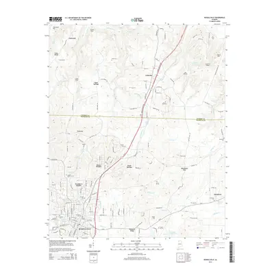
2014 Map of Russellville
USGS Topo · Published 2014About this map
Russellville serves as a focal point at the junction of the George Wallace Hwy and the local rail network, illustrating the development of this Alabama community. Northward, the landscape transitions across the Colbert Co and Franklin Co line, where smaller residential clusters like Littleville and Ligon Springs are situated amidst a network of springs and creeks. The terrain is defined by prominent elevations such as Coburn Mtn and Underwood Mtn, with the northern reaches featuring a large Quarry and several upland flats like Flatwoods. Numerous family and community burial grounds, including the Old Town Cem and Tharptown Cem, are distributed throughout the rural countryside, providing significant landmarks for genealogical research. Water features such as Hyde Lake and the various branches of Spring Creek influence the local topography, marking the drainage patterns that have historically shaped settlement in this part of the state.
Find a feature on this map
104 named features on this map. Tap any name to fly to it.
Don’t see what you’re looking for? This feature index may not catch every label — zoom into the map to look around manually.
Map Details
Editions of this 2014 Russellville Map
This is the sole edition of this map. No revisions or reprints were ever made.
Other maps of this area

1924 · Tuscumbia
USGS Topo · 1:48,000

1925 · Barton
USGS Topo · 1:62,500

1926 · Tuscumbia
USGS Topo · 1:62,500

1926 · Barton
USGS Topo · 1:48,000

1929 · Barton
USGS Topo · 1:62,500

1936 · Russellville
USGS Topo · 1:24,000

1936 · Newburg
USGS Topo · 1:24,000

1936 · Frankfort
USGS Topo · 1:24,000

1936 · Isbell
USGS Topo · 1:24,000

1936 · Pride
USGS Topo · 1:24,000