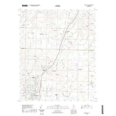
2020 Map of Russellville
USGS Topo · Published 2020About this map
Russellville serves as the focal point of this Northwest Alabama study, where the Franklin County Courthouse anchors a city layout branching into neighborhoods like Woodlawn Heights and Hester Heights. The landscape is defined by the sharp transition from the residential street grids of the valley to the dissected ridges and hollows of the Highland Rim. These highlands are punctuated by prominent features such as Underwood Mtn and Coburn Mtn, while the water system is characterized by numerous small springs and branches like Chalybeate Spring and Stinking Bear Cr. For the family historian, the map preserves the location of many small burial sites outside the larger Franklin Memory Gardens, including Devaney Cem, Sadler Cem, and the Knights of Pythias Cem, alongside rural outliers like Tharp Cem and Henson Cem.
Find a feature on this map
185 named features on this map. Tap any name to fly to it.
Don’t see what you’re looking for? This feature index may not catch every label — zoom into the map to look around manually.
Map Details
Editions of this 2020 Russellville Map
This is the sole edition of this map. No revisions or reprints were ever made.
Other maps of this area

1924 · Tuscumbia
USGS Topo · 1:48,000

1925 · Barton
USGS Topo · 1:62,500

1926 · Tuscumbia
USGS Topo · 1:62,500

1926 · Barton
USGS Topo · 1:48,000

1929 · Barton
USGS Topo · 1:62,500

1936 · Russellville
USGS Topo · 1:24,000

1936 · Newburg
USGS Topo · 1:24,000

1936 · Frankfort
USGS Topo · 1:24,000

1936 · Isbell
USGS Topo · 1:24,000

1936 · Pride
USGS Topo · 1:24,000