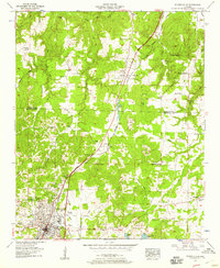
1957 Map of Russellville
USGS Topo · Published 1958About this map
Russellville serves as the focal point of this North Alabama landscape, situated just before the rise of the Colbert and Franklin County line. The town's mid-century infrastructure is well-defined, showing the Betty Wilson Hospital, a radio tower, and the Athletic field near the city center. The Southern Railway and the historic Jackson Highway provide the primary transit corridors, while the presence of a prison camp and several strip mines further north indicates the region's industrial and correctional land use during the 1950s.
Find a feature on this map
65 named features on this map. Tap any name to fly to it.
Don’t see what you’re looking for? This feature index may not catch every label — zoom into the map to look around manually.
Map Details
Editions of this 1957 Russellville Map
This is the sole edition of this map. No revisions or reprints were ever made.
Other maps of this area

1924 · Tuscumbia
USGS Topo · 1:48,000

1925 · Barton
USGS Topo · 1:62,500

1926 · Tuscumbia
USGS Topo · 1:62,500

1926 · Barton
USGS Topo · 1:48,000

1929 · Barton
USGS Topo · 1:62,500

1936 · Russellville
USGS Topo · 1:24,000

1936 · Newburg
USGS Topo · 1:24,000

1936 · Frankfort
USGS Topo · 1:24,000

1936 · Isbell
USGS Topo · 1:24,000

1936 · Pride
USGS Topo · 1:24,000