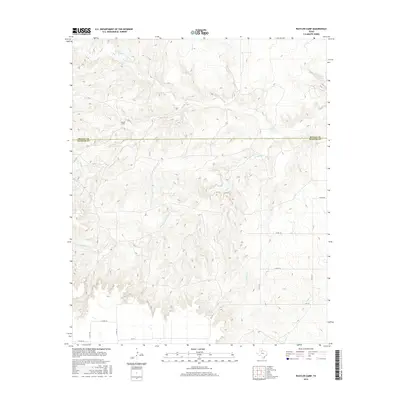
2016 Map of Rustler Camp
USGS Topo · Published 2016About this map
Rustler Camp stands as a focal point in this landscape where the high plains of West Texas meet the sharp breaks of the Caprock. Situated along the border of Motley Co and Dickens Co, the area is defined by a network of seasonal drainages including Wolf Cr, Rustler Cr, and Grapevine Cr. These watercourses carve through the terrain, leading toward significant local water sources such as Wolf Springs and the nearby Roaring Springs. The map reveals a remote ranching environment where infrastructure is sparse, primarily consisting of county roads like Co RD 110 and Co RD 121 that navigate the complex topography. The presence of FM 193 in the southern portion provides the primary modern transit corridor through this section of the Rolling Plains, connecting isolated camps and water holes that have served the region's cattle industry for generations.
Find a feature on this map
18 named features on this map. Tap any name to fly to it.
Don’t see what you’re looking for? This feature index may not catch every label — zoom into the map to look around manually.
Map Details
Editions of this 2016 Rustler Camp Map
This is the sole edition of this map. No revisions or reprints were ever made.
Other maps of this area
1954 · Lubbock
USGS Topo · 1:250,000
1965 · Wake
USGS Topo · 1:24,000
1966 · McAdoo
USGS Topo · 1:24,000
1967 · Dickens North
USGS Topo · 1:24,000
1967 · Haystack Mountain
USGS Topo · 1:24,000
1968 · Mac Bain
USGS Topo · 1:24,000
1968 · Roaring Springs
USGS Topo · 1:24,000
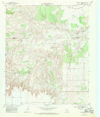
1968 · Rustler Camp
USGS Topo · 1:24,000
1968 · Dougherty
USGS Topo · 1:24,000
1968 · Afton
USGS Topo · 1:24,000