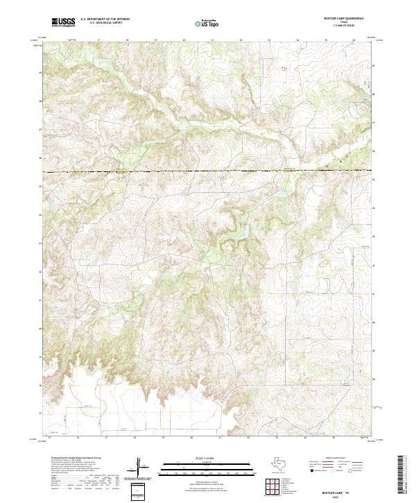
2022 Map of Rustler Camp
USGS Topo · Published 2022About this map
Wolf Springs and the headwaters of Wolf Cr characterize this landscape on the border of Motley and Dickens Counties. The terrain is defined by a dense network of seasonal drainage channels, including Rustler Cr and Mexican Cr, which cut through the High Plains. Modern infrastructure is concentrated in the southern and eastern portions of the map, where Farm to Market Road 193 and a series of county roads like County Road 113 provide access to the rural ranching and agricultural land. In the northeast corner, Roaring Springs marks a rare perennial water source in this arid region. The drainage patterns of Grapevine Creek and its tributaries reveal a complex topography of breaks and canyons that transition from the flatter tablelands to the more dissected drainage basins characteristic of the Rolling Plains.
Find a feature on this map
19 named features on this map. Tap any name to fly to it.
Don’t see what you’re looking for? This feature index may not catch every label — zoom into the map to look around manually.
Map Details
Editions of this 2022 Rustler Camp Map
This is the sole edition of this map. No revisions or reprints were ever made.
Other maps of this area

1954 · Lubbock
USGS Topo · 1:250,000

1965 · Wake
USGS Topo · 1:24,000

1966 · McAdoo
USGS Topo · 1:24,000

1967 · Dickens North
USGS Topo · 1:24,000

1967 · Haystack Mountain
USGS Topo · 1:24,000

1968 · Mac Bain
USGS Topo · 1:24,000

1968 · Roaring Springs
USGS Topo · 1:24,000

1968 · Rustler Camp
USGS Topo · 1:24,000
1968 · Dougherty
USGS Topo · 1:24,000

1968 · Afton
USGS Topo · 1:24,000