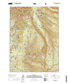
2020 Map of Rustler Peak
USGS Topo · Published 2020About this map
Rustler Peak and the high ridges of the Cascade Range dominate this landscape, which spans the boundary between Jackson and Klamath counties. This 2020 survey illustrates the complex watershed where the S Fork Rogue River begins its descent through the Rogue River National Forest. The map detail highlights an area focused on recreation and forest management, centering on the Parker Meadows Campground and a network of Forest Service corridors like Route 37.
Find a feature on this map
60 named features on this map. Tap any name to fly to it.
Don’t see what you’re looking for? This feature index may not catch every label — zoom into the map to look around manually.
Map Details
Editions of this 2020 Rustler Peak Map
This is the sole edition of this map. No revisions or reprints were ever made.
Other maps of this area

1891 · Ashland
USGS Topo · 1:250,000

1893 · Ashland
USGS Topo · 1:250,000

1897 · Ashland
USGS Topo · 1:250,000

1955 · Lake O' Woods
USGS Topo · 1:62,500

1955 · Rustler Peak
USGS Topo · 1:62,500

1955 · Mt. Mc Loughlin
USGS Topo · 1:62,500

1955 · Pelican Butte
USGS Topo · 1:62,500

1955 · Medford
USGS Topo · 1:250,000

1957 · Medford
USGS Topo · 1:250,000

1958 · Medford
USGS Topo · 1:250,000