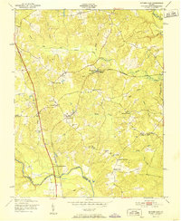
1951 Map of Ruther Glen
USGS Topo · Published 1951About this map
The Richmond Fredericksburg and Potomac railroad corridor dictates the settlement pattern of this rural Caroline County landscape, anchoring the community at Ruther Glen. This 1951 record shows a region defined by family-named intersections and railroad crossings, such as Patersons Corner, Swans Corner, and Colemans Mill Crossing. These locations served as localized hubs for a community connected by a network of rural schools including Cassia Sch and Ruther Glen Sch, alongside numerous country churches like Jericho Ch and Second Baptist Ch.
Find a feature on this map
44 named features on this map. Tap any name to fly to it.
Don’t see what you’re looking for? This feature index may not catch every label — zoom into the map to look around manually.
Map Details
Editions of this 1951 Ruther Glen Map
This is the sole edition of this map. No revisions or reprints were ever made.
Other maps of this area

1887 · Spottsylvania
USGS Topo · 1:125,000

1889 · Fredericksburg
USGS Topo · 1:125,000

1890 · Goochland
USGS Topo · 1:125,000

1892 · Fredericksburg
USGS Topo · 1:125,000

1892 · Spottsylvania
USGS Topo · 1:125,000

1892 · Goochland
USGS Topo · 1:125,000

1894 · Fredericksburg
USGS Topo · 1:125,000

1918 · Doswell
USGS Topo · 1:62,500

1942 · Bowling Green
USGS Topo · 1:31,680

1942 · Woodford
USGS Topo · 1:31,680