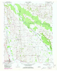
1954 Map of Rutherford
USGS Topo · Published 1981About this map
Rutherford anchor the southwestern corner of this West Tennessee landscape, where the Illinois Central Gulf railroad tracks run parallel to the Rutherford Fork Obion River. This territory is defined by the convergence of several major waterways, including the Middle Fork Obion River and the South Fork Obion River, which snake through low-lying bottomlands and cross county boundaries between Obion, Weakley, and Gibson.
Find a feature on this map
22 named features on this map. Tap any name to fly to it.
Don’t see what you’re looking for? This feature index may not catch every label — zoom into the map to look around manually.
Map Details
Editions of this 1954 Rutherford Map
3 editions found
Other maps of this area

1950 · Martin
USGS Topo · 1:24,000

1950 · Rives
USGS Topo · 1:24,000

1951 · Rives
USGS Topo · 1:24,000

1953 · Dyer
USGS Topo · 1:24,000

1954 · Rutherford
USGS Topo · 1:24,000

1954 · Greenfield
USGS Topo · 1:24,000

1954 · Bradford
USGS Topo · 1:24,000

1956 · Gardner
USGS Topo · 1:24,000

1956 · Dyersburg
USGS Topo · 1:250,000
1964 · Yorkville
USGS Topo · 1:24,000