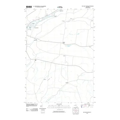
2010 Map of Rutland Center
USGS Topo · Published 2010About this map
Huntingtonville and East Watertown anchor the western edge of this Jefferson County landscape, where the Black River carves a path through the northern reaches. The terrain is marked by significant rises like Underwood Hill and Orvis Hill, while a network of cemeteries—including Calvary Cemetery, Maple Hill Cemetery, and Cotes Cemetery—provide important landmarks for genealogical research across the central townships.
Find a feature on this map
27 named features on this map. Tap any name to fly to it.
Don’t see what you’re looking for? This feature index may not catch every label — zoom into the map to look around manually.
Map Details
Editions of this 2010 Rutland Center Map
This is the sole edition of this map. No revisions or reprints were ever made.
Other maps of this area

1895 · Watertown
USGS Topo · 1:62,500

1898 · Watertown
USGS Topo · 1:62,500

1902 · Carthage
USGS Topo · 1:62,500

1903 · Theresa
USGS Topo · 1:62,500

1904 · Carthage
USGS Topo · 1:62,500

1908 · Watertown
USGS Topo · 1:62,500

1909 · Watertown
USGS Topo · 1:62,500

1911 · Antwerp
USGS Topo · 1:62,500

1942 · Copenhagen
USGS Topo · 1:24,000
1943 · Barnes Corners
USGS Topo · 1:31,680