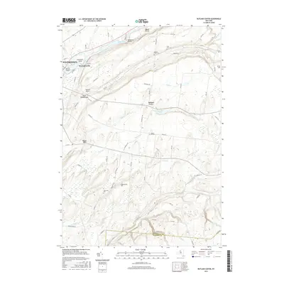
2016 Map of Rutland Center
USGS Topo · Published 2016About this map
The Black River carves the northern landscape of this Jefferson County region, flowing past Huntington Island and the community of Huntingtonville as it approaches the eastern edge of Watertown. The terrain is defined by a series of distinct hollows and uplands, including Rutland Hollow and Woodward Sidehill, which shaped the settlement patterns of agricultural hamlets like Rutland Center and Burrs Mills. Local historians will find a high density of ancestral sites, with numerous burial grounds such as Maple Hill Cem, Underwood Cem, and Cotes Cem scattered across the countryside.
Find a feature on this map
75 named features on this map. Tap any name to fly to it.
Don’t see what you’re looking for? This feature index may not catch every label — zoom into the map to look around manually.
Map Details
Editions of this 2016 Rutland Center Map
This is the sole edition of this map. No revisions or reprints were ever made.
Other maps of this area

1895 · Watertown
USGS Topo · 1:62,500

1898 · Watertown
USGS Topo · 1:62,500

1902 · Carthage
USGS Topo · 1:62,500

1903 · Theresa
USGS Topo · 1:62,500

1904 · Carthage
USGS Topo · 1:62,500

1908 · Watertown
USGS Topo · 1:62,500

1909 · Watertown
USGS Topo · 1:62,500

1911 · Antwerp
USGS Topo · 1:62,500

1942 · Copenhagen
USGS Topo · 1:24,000
1943 · Barnes Corners
USGS Topo · 1:31,680