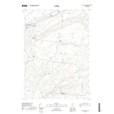
2019 Map of Rutland Center
USGS Topo · Published 2019About this map
Watertown and the northern reaches of the Black River dominate this modern landscape, where urban development transitions into the rolling agricultural lands of Jefferson County. The river's path is marked by distinctive features such as Huntington Island and Delano Island, while the surrounding hillsides are dotted with historic burial grounds including Calvary Cem and Clark Cem. Settlements like East Watertown and Rutland Center are connected by a network of rural roads that follow the natural topography, illustrating the area's continued reliance on early transport corridors such as Middle RD and Co RD 49. The map also captures the varied hydrology of the region, from the headwaters of Staplin Cr to the small basin of Rutland Lake. Family names and historical hamlets remain preserved in the nomenclature of places like Burrs Mills and the Underwood Hill vicinity, offering a clear record of local lineage near the boundary with Lewis County.
Find a feature on this map
71 named features on this map. Tap any name to fly to it.
Don’t see what you’re looking for? This feature index may not catch every label — zoom into the map to look around manually.
Map Details
Editions of this 2019 Rutland Center Map
This is the sole edition of this map. No revisions or reprints were ever made.
Other maps of this area

1895 · Watertown
USGS Topo · 1:62,500

1898 · Watertown
USGS Topo · 1:62,500

1902 · Carthage
USGS Topo · 1:62,500

1903 · Theresa
USGS Topo · 1:62,500

1904 · Carthage
USGS Topo · 1:62,500

1908 · Watertown
USGS Topo · 1:62,500

1909 · Watertown
USGS Topo · 1:62,500

1911 · Antwerp
USGS Topo · 1:62,500

1942 · Copenhagen
USGS Topo · 1:24,000
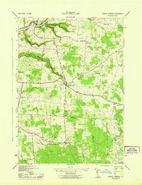
1943 · Barnes Corners
USGS Topo · 1:31,680