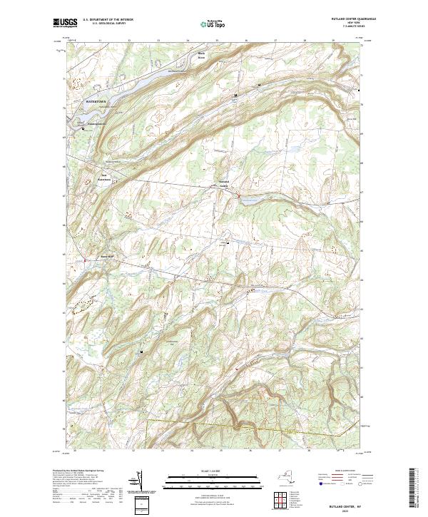
2023 Map of Rutland Center
USGS Topo · Published 2023About this map
The Black River forms a dominant northern border for this Jefferson County landscape, winding past the industrial outskirts of Watertown and the northern tip of Delano Island. This modern survey illustrates the persistent rural character of the area just east of the city, where small clusters like Huntingtonville and East Watertown transition into the farming plateaus of Rutland Center. The drainage patterns of Staplin Creek and Boynton Creek define the local topography, leading toward the landmark Burrville Cider Mill-Falls at Burrs Mills.
Find a feature on this map
78 named features on this map. Tap any name to fly to it.
Don’t see what you’re looking for? This feature index may not catch every label — zoom into the map to look around manually.
Map Details
Editions of this 2023 Rutland Center Map
This is the sole edition of this map. No revisions or reprints were ever made.
Other maps of this area

1895 · Watertown
USGS Topo · 1:62,500

1898 · Watertown
USGS Topo · 1:62,500

1902 · Carthage
USGS Topo · 1:62,500

1903 · Theresa
USGS Topo · 1:62,500

1904 · Carthage
USGS Topo · 1:62,500

1908 · Watertown
USGS Topo · 1:62,500

1909 · Watertown
USGS Topo · 1:62,500

1911 · Antwerp
USGS Topo · 1:62,500

1942 · Copenhagen
USGS Topo · 1:24,000
1943 · Barnes Corners
USGS Topo · 1:31,680