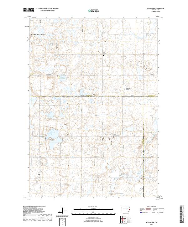
2021 Map of Rutland NW
USGS Topo · Published 2021About this map
Coteau des Prairies, a vast glacial highland, defines the topography of this region where three South Dakota counties converge. The landscape is dotted with prominent wetlands and water bodies, including Pederson Slough, Molumby Slough, and the expansive Mud Lake. These natural features dictated the early settlement patterns of the late 19th and early 20th centuries, as seen in the placement of rural landmarks like the Oslo Lutheran Cem and Prairie Queen Cem. The map illustrates the transition from the high plateau down toward the drainage of Battle Creek, showing how the section-line road grid adapts to the irregular terrain of the prairie potholes. Local history is anchored by these small, scattered cemeteries and the winding course of the creek, which reflect the enduring agricultural and spiritual footprints of the families who first farmed this portion of Lake County, Brookings County, and Moody County.
Find a feature on this map
46 named features on this map. Tap any name to fly to it.
Don’t see what you’re looking for? This feature index may not catch every label — zoom into the map to look around manually.
Map Details
Editions of this 2021 Rutland NW Map
This is the sole edition of this map. No revisions or reprints were ever made.
Other maps of this area

1953 · Watertown
USGS Topo · 1:250,000

1958 · Watertown
USGS Topo · 1:250,000

1964 · Brookings
USGS Topo · 1:24,000

1964 · Medary
USGS Topo · 1:24,000

1964 · Rutland SE
USGS Topo · 1:24,000

1968 · Lake Sinai
USGS Topo · 1:24,000

1968 · Volga
USGS Topo · 1:24,000

1968 · Madison
USGS Topo · 1:24,000

1968 · Sinai
USGS Topo · 1:24,000
1968 · Rutland
USGS Topo · 1:24,000
Featured Places
- Camridge Hutterite Colony, SD
- Oslo Township, SD
- Medary Township, SD
- Summit Township, SD
- Fremont Township, SD