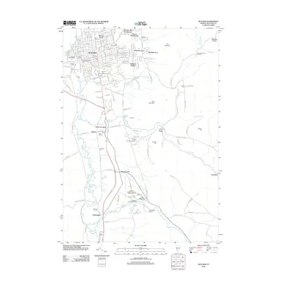
2012 Map of Rutland
USGS Topo · Published 2012About this map
Rutland and its surrounding developments like Marolin Acres and Heritage Hill Development form the urban core of this 2012 survey. The landscape quickly transitions from the residential streets of Killington Heights and Grandview Acres to the more rural and rugged stretches of East Mountain and Bald Mountain. Waterways define the local geography, with the Cold River and Mill River cutting through the valley floor, while the Clarendon Gorge offers a distinct geological landmark south of the city.
Find a feature on this map
96 named features on this map. Tap any name to fly to it.
Don’t see what you’re looking for? This feature index may not catch every label — zoom into the map to look around manually.
Map Details
Editions of this 2012 Rutland Map
This is the sole edition of this map. No revisions or reprints were ever made.
Other maps of this area

1891 · Rutland
USGS Topo · 1:62,500

1893 · Wallingford
USGS Topo · 1:62,500

1893 · Rutland
USGS Topo · 1:62,500

1894 · Pawlet
USGS Topo · 1:62,500

1895 · Castleton
USGS Topo · 1:62,500

1897 · Pawlet
USGS Topo · 1:62,500

1897 · Castleton
USGS Topo · 1:62,500

1903 · Mettawee
USGS Topo · 1:125,000

1944 · Proctor
USGS Topo · 1:31,680
1946 · Proctor
USGS Topo · 1:31,680