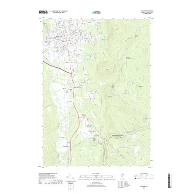
2018 Map of Rutland
USGS Topo · Published 2018About this map
Otter Creek and its many tributaries, including Moon Brook and Mussey Brook, define the valley landscape south of the city of Rutland. This 2018 survey documents a region where dense urban development transitions into the foothills of the Green Mountains, characterized by numerous burial grounds that speak to the area's long settlement history. Genealogists and local historians will find several notable sites, such as the Old West Street Cem and the Lydias-Wheelerville Road Cem located near East Mtn.
Find a feature on this map
47 named features on this map. Tap any name to fly to it.
Don’t see what you’re looking for? This feature index may not catch every label — zoom into the map to look around manually.
Map Details
Editions of this 2018 Rutland Map
This is the sole edition of this map. No revisions or reprints were ever made.
Other maps of this area

1891 · Rutland
USGS Topo · 1:62,500

1893 · Wallingford
USGS Topo · 1:62,500

1893 · Rutland
USGS Topo · 1:62,500

1894 · Pawlet
USGS Topo · 1:62,500

1895 · Castleton
USGS Topo · 1:62,500

1897 · Pawlet
USGS Topo · 1:62,500

1897 · Castleton
USGS Topo · 1:62,500

1903 · Mettawee
USGS Topo · 1:125,000

1944 · Proctor
USGS Topo · 1:31,680
1946 · Proctor
USGS Topo · 1:31,680