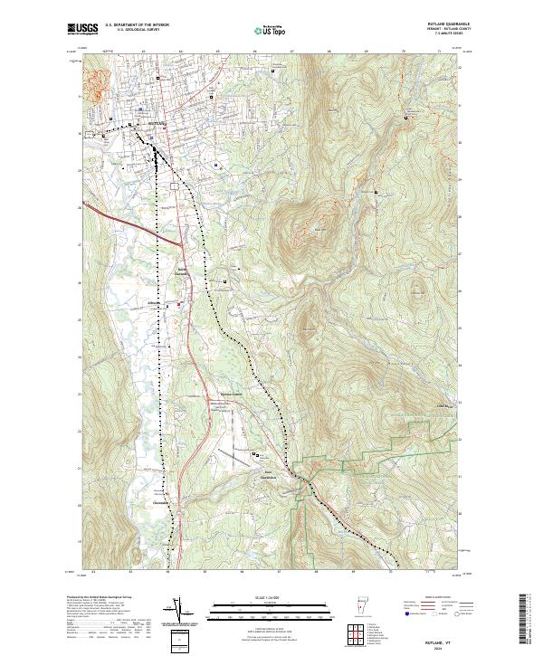
2024 Map of Rutland
USGS Topo · Published 2024About this map
The Vermont Railway corridor and the Otter Creek valley anchor this map, showing the established infrastructure of south-central Vermont. The landscape is defined by its numerous historic burying grounds, ranging from the large Calvary Cem and West Street Cem in Rutland to smaller family or community plots such as Clarendon Flats Cem and Lydias - Wheelerville Road Cem. These sites, along with the Rutland Jewish Cem, provide significant markers for genealogical research in a region where settlement follows the river valleys and the foot of the Green Mountains.
Find a feature on this map
92 named features on this map. Tap any name to fly to it.
Don’t see what you’re looking for? This feature index may not catch every label — zoom into the map to look around manually.
Map Details
Editions of this 2024 Rutland Map
This is the sole edition of this map. No revisions or reprints were ever made.
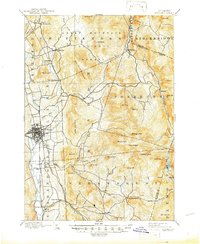
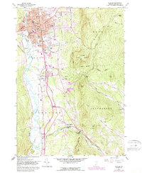
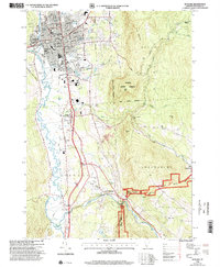
Historical Maps of Grandview Acres Through Time
6 maps found