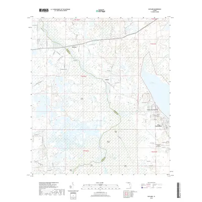
2018 Map of Rutland
USGS Topo · Published 2018About this map
The Withlacoochee River carves a winding path along the western boundary of this landscape, defining the border between Citrus and Sumter counties. In this interior section of Florida, the terrain is characterized by an extensive network of wetlands and named high points such as Graveyard Island and Bear Island. The settlement of Rutland, situated near the Rutland Cem, serves as a local focal point alongside the smaller community of Carlson. To the east, the waters of Lake Panasoffkee and the Outlet River dominate the geography, supporting the residential developments of Panacoochee Retreats. The presence of Montgomery's Flying M Ranch Airport and various sloughs and swamps, including Jumper Creek Swamp and Gum Swamp, illustrates a landscape where human habitation and aviation must navigate a complex, water-heavy environment.
Find a feature on this map
89 named features on this map. Tap any name to fly to it.
Don’t see what you’re looking for? This feature index may not catch every label — zoom into the map to look around manually.
Map Details
Editions of this 2018 Rutland Map
This is the sole edition of this map. No revisions or reprints were ever made.
Other maps of this area

1893 · Panasoffkee
USGS Topo · 1:62,500

1895 · Tsala Apopka
USGS Topo · 1:62,500

1895 · Panasoffkee
USGS Topo · 1:62,500

1954 · Nobleton
USGS Topo · 1:24,000

1954 · Tsala Apopka NE
USGS Topo · 1:24,000

1954 · Inverness
USGS Topo · 1:24,000

1954 · Inverness
USGS Topo · 1:62,500

1955 · Plant City
USGS Topo · 1:250,000

1958 · Plant City
USGS Topo · 1:250,000

1958 · Bushnell
USGS Topo · 1:24,000