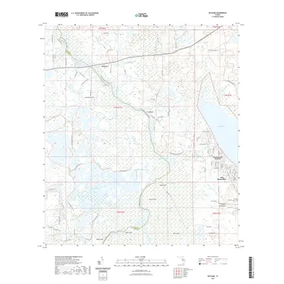
2021 Map of Rutland
USGS Topo · Published 2021About this map
The Withlacoochee River carves a winding path through the borderlands of Sumter and Citrus counties, defining a landscape dominated by expansive wetlands and island-like rises. This 2021 survey reveals a complex hydrological network where the Outlet River connects the massive Lake Panasoffkee to the primary river channel. Scattered settlements such as Rutland and Carlson are situated along key corridors, while Panacoochee Retreats marks the development along the lake’s western shore. Genealogists and local researchers will find the Rutland Cem and the evocatively named Graveyard Island within the swamps north of Grand Prairie. To the south, the terrain fragments into a mosaic of named features including Kettle Island, Shell Island, and Bear Island, all bordered by the dense Jumper Creek Swamp. The presence of Montgomery's Flying M Ranch Airport highlights the specialized land use in this riverine environment.
Find a feature on this map
91 named features on this map. Tap any name to fly to it.
Don’t see what you’re looking for? This feature index may not catch every label — zoom into the map to look around manually.
Map Details
Editions of this 2021 Rutland Map
This is the sole edition of this map. No revisions or reprints were ever made.
Other maps of this area

1893 · Panasoffkee
USGS Topo · 1:62,500

1895 · Tsala Apopka
USGS Topo · 1:62,500

1895 · Panasoffkee
USGS Topo · 1:62,500

1954 · Nobleton
USGS Topo · 1:24,000

1954 · Tsala Apopka NE
USGS Topo · 1:24,000

1954 · Inverness
USGS Topo · 1:24,000

1954 · Inverness
USGS Topo · 1:62,500

1955 · Plant City
USGS Topo · 1:250,000

1958 · Plant City
USGS Topo · 1:250,000

1958 · Bushnell
USGS Topo · 1:24,000