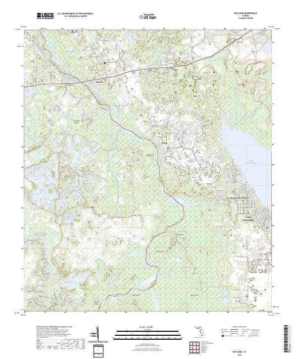
2024 Map of Rutland
USGS Topo · Published 2024About this map
The Withlacoochee River defines the landscape of this Central Florida region, winding along the border between Sumter and Citrus counties. The settlement of Rutland sits at a strategic crossing point, supported by the nearby Rutland Cemetery and surrounded by a complex network of wetlands and sloughs. To the east, the waters of Lake Panasoffkee and the Panacoochee Retreats community mark a transition into more concentrated residential areas, while the vast western reaches are dominated by the Tsala Apopka Lake system. The map reveals a mosaic of named islands and prairies, such as Graveyard Island, Kettle Island, and Grand Prairie, that emerge from the swampy lowlands of the Jumper Creek Swamp. This document also captures contemporary infrastructure like the Montgomery's Flying M Ranch Airport, illustrating how local aviation and rural county roads have integrated into this historically water-dependent environment.
Find a feature on this map
97 named features on this map. Tap any name to fly to it.
Don’t see what you’re looking for? This feature index may not catch every label — zoom into the map to look around manually.
Map Details
Editions of this 2024 Rutland Map
This is the sole edition of this map. No revisions or reprints were ever made.
Other maps of this area

1893 · Panasoffkee
USGS Topo · 1:62,500

1895 · Tsala Apopka
USGS Topo · 1:62,500

1895 · Panasoffkee
USGS Topo · 1:62,500

1954 · Nobleton
USGS Topo · 1:24,000

1954 · Tsala Apopka NE
USGS Topo · 1:24,000

1954 · Inverness
USGS Topo · 1:24,000

1954 · Inverness
USGS Topo · 1:62,500

1955 · Plant City
USGS Topo · 1:250,000

1958 · Plant City
USGS Topo · 1:250,000

1958 · Bushnell
USGS Topo · 1:24,000