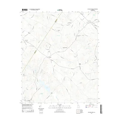
2014 Map of Rutledge North
USGS Topo · Published 2014About this map
Lake Rutledge and the serpentine course of Hard Labor Creek anchor this Piedmont landscape along the boundary of Walton and Morgan counties. The map reflects a rural community structured by long-standing family and church hubs, centered around small crossroads like Fairplay and Malcolms Store. The importance of local heritage is evident in the numerous burial grounds and congregations, including Gresham Grove Baptist Church Cem and Chestnut Grove Cem, which serve as cornerstones for regional genealogy.
Find a feature on this map
94 named features on this map. Tap any name to fly to it.
Don’t see what you’re looking for? This feature index may not catch every label — zoom into the map to look around manually.
Map Details
Editions of this 2014 Rutledge North Map
This is the sole edition of this map. No revisions or reprints were ever made.
Other maps of this area

1896 · Monroe
USGS Topo · 1:125,000

1953 · Athens
USGS Topo · 1:250,000

1958 · Athens
USGS Topo · 1:250,000

1959 · Athens
USGS Topo · 1:250,000

1963 · Athens
USGS Topo · 1:250,000

1964 · High Shoals
USGS Topo · 1:24,000

1964 · Watkinsville
USGS Topo · 1:24,000

1964 · Monroe
USGS Topo · 1:24,000

1971 · Rutledge North
USGS Topo · 1:24,000
1971 · Social Circle
USGS Topo · 1:24,000